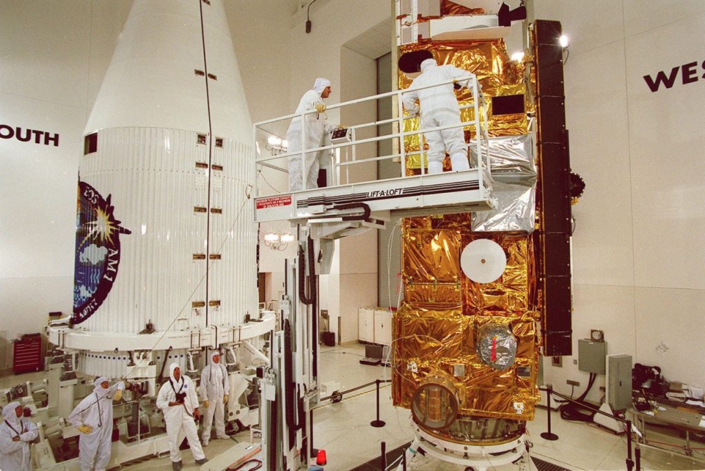
NASA’s Terra satellite will stop collecting science data on 1 December after 27 years of observing Earth’s atmosphere, land, oceans, ice and living systems. The mission was designed to last six years. Aging spacecraft systems and a drifting orbit have now brought its observation phase to an end.
Ending operations does not erase the record Terra created. NASA says the data will remain freely available, leaving researchers with more than a quarter-century of measurements used to study wildfires, land-use change, clouds, pollution, ice cover and other parts of a connected Earth system.
The NASA Terra mission announcement also separates three dates that can easily be confused: science collection ends on 1 December 2026, the spacecraft will use remaining fuel to lower its orbit, and NASA plans to power off all systems in January 2027.
Why the NASA Terra mission is ending
Terra launched in December 1999 as the flagship of NASA’s Earth Observing System. Its longevity far exceeded the original six-year design, but extended operation cannot stop hardware from aging or an orbit from changing.
Earth-observation satellites are placed in carefully selected orbits so instruments pass over locations under useful and repeatable conditions. As Terra’s orbit drifts, the local time and geometry of its observations change. That affects how measurements can be compared, especially for variables influenced by sunlight and the daily cycle.
NASA had already shut down the MOPITT instrument and parts of CERES and ASTER to conserve power. The agency’s decision therefore closes a mission that had been managing declining resources rather than one operating exactly as it did at launch.
Five instruments gave Terra complementary views
Terra was valuable because its five instruments measured different properties from the same platform:
- MODIS, the Moderate Resolution Imaging Spectroradiometer, observed Earth across many wavelengths and produced widely used records of vegetation, fires, clouds, aerosols, snow and ocean color.
- ASTER, the Advanced Spaceborne Thermal Emission and Reflection Radiometer, provided higher-resolution visible, infrared and thermal observations for mapping land surfaces, hazards and temperature.
- MISR, the Multi-angle Imaging SpectroRadiometer, viewed Earth from several angles, helping researchers distinguish particles, clouds and surface features.
- CERES, the Clouds and the Earth’s Radiant Energy System, measured the energy entering and leaving the planet.
- MOPITT, Measurements of Pollution in the Troposphere, tracked carbon monoxide and helped reveal how pollution moves through the atmosphere.
No single instrument tells the whole story. A smoke plume’s visible extent, particle properties, atmospheric transport and effect on the planet’s energy balance require different measurements and analysis methods.
This is also why “Terra is ending” does not mean Earth observation is ending. Other satellites continue related measurements, but they may use different instruments, orbits, resolutions and calibration histories. Continuity has to be demonstrated variable by variable.
What happens to the data after observations stop
NASA says Terra’s data records will remain free and publicly available. The archive includes raw observations and processed products built with algorithms, calibration information and quality flags.
A long record becomes more useful when researchers can compare measurements consistently across time. That work does not end when the spacecraft powers off. Teams can reprocess historical observations with improved calibration, combine them with other missions and use the archive to test new methods.
Readers should distinguish an archived measurement from an unchanging scientific conclusion. The pixels remain available, but their interpretation can improve as researchers learn more about instrument behavior, atmospheric effects and the physical systems being observed.
Future & Fact’s guide to climate-change evidence explains why satellites are one part of a broader evidence system that also includes surface measurements, oceans, ice, atmospheric samples and physical models.
Lowering the orbit is part of responsible closure
NASA plans to use Terra’s remaining fuel to lower its orbit before turning off the spacecraft. The announcement does not give a final reentry date, so it would be premature to describe an imminent descent through the atmosphere.
The maneuver changes the spacecraft’s long-term orbital path and is part of decommissioning. Controllers must complete it while Terra can still respond to commands and while enough fuel and functioning hardware remain.
Powering off is therefore not a simple switch after the last science image. Mission teams must safeguard data, configure the spacecraft, perform planned maneuvers and document its final state.
What scientists lose when Terra stops
The archive preserves the past, but it cannot add another observation after 1 December. That matters for measurements whose value comes from repeated, comparable sampling over decades.
The effect will differ by product. Some Terra records overlap with measurements from NASA’s Aqua satellite or newer missions; others depend on specific instrument channels, viewing angles, overpass times or calibration histories. Researchers may bridge records by overlapping old and new instruments, but combining them can require careful correction rather than a direct splice.
For an individual fire, storm or dust event, newer satellites may offer faster or sharper imagery. For a 25-year trend, consistency can be more important than the newest resolution. Both uses are scientifically legitimate, but they answer different questions.
How to read claims based on the Terra record
When a study cites Terra data, readers can ask four practical questions:
- Which instrument and product were used?
- What time period, spatial resolution and quality filters apply?
- Was the record reprocessed or combined with another satellite?
- How did researchers account for orbit drift, calibration changes and missing observations?
These questions do not undermine satellite evidence. They show how measurement becomes a defensible scientific record. Our explanation of how scientific evidence works describes the same chain from instrument and method to uncertainty and replication.
Terra’s final science day will close an unusually long observing mission, not the scientific use of its measurements. The spacecraft’s most durable product is the calibrated record it leaves behind—and the ability of future researchers to question, combine and reinterpret that record.